Marysvale Loop #02 Marysvale Loop #02
This loop trail is actually two legs going east and west from the town of Marysvale. These legs each loin the main Paiute ATV Trail, thus forming the loop. Approximate Section Time
· Marysvale west to main Paiute Trail -- 0.5 hr
· Marysvale east to main Paiute Trail -- 0.5 hr
The town of Marysvale is located at 5,850 feet elevation. From there the trail westward rises to 6,000 feet at the mouth of Beaver Creek Canyon and then to 9,500 feet at the western junction with the main trail. Going eastward the loop trail descends to 5,832 feet at the crossing of the Sevier River before rising to 6,800 feet at the mouth of Dry Creek Canyon and 8,924 feet at the eastern junction with the main trail near Dry Creek Guard Station. 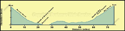
Heading westward out of Marysvale the trail turns north ward at the west edge of town and heads up Forest Road 113. After a short distance across sagebrush flats the trail turns west up Beaver Creek. This is a good, well traveled road, so be cautious of other traffic. Along the creek bottom, cottonwood trees and lush vegetation mark the streamside riparian zone. This is an important area for many animals in this desert environment. A healthy riparian area also is necessary for delivering clean water to the valleys below. Pinyon and juniper dot the dry hillsides, but soon give way to spruce and fir as the main trail is reached at the junction with Forest Road 123. 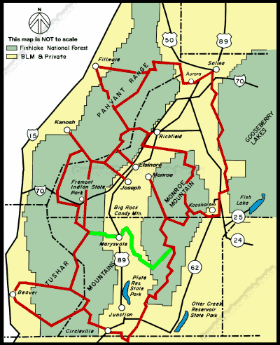
continued next page
|